Satellite Fields is a series of large-scale land art formations created on the plains of North Dakota. Each piece is composed of hundreds of living trees, planted in stark geometric formations, so that they are visible and “visitable” by satellite imagery such as Google Earth. In its constantly evolving “final form”, Satellite Fields attempts to re-map the shifting border regions of the natural world in two ways: 1) by examining how virtual space is changing our relationship to both nature and technology and 2) by asking how nature is evolving and being modified by the agendas of science, technology, and global economics. Like Mary Shelley’s Frankenstein – perhaps the first piece of modern literature to imagine the supernatural nightmare of human/scientific intervention into natural life – Satellite Fields animates the ways in which our interventions into nature continue beyond our control, as nature moves forward with a life and mind of its own.
SUPERNATURAL HYPERSPACE: Satellite Fields is a virtual artwork. While existing in a remote natural setting, Satellite Fields also creates a “hyper-location” that distorts both time and space, encouraging visitors to re-envision our relationship to both nature and technology. Covering 4-acres of land on the flat empty plains of North Dakota, each formation can be viewed from two perspectives: in-person or via internet programs such as Google Earth. In-person visitors can engage with the formations as a sculptural piece (in the tradition of earth art), while internet visitors will experience each piece in different, more virtual terms. From an aerial perspective, such as a satellite photograph, the formations will appear as an abstract design embedded in the landscape – a living composition that evolves over time. Satellite Fields exists in both worlds simultaneously, mirroring the logic of our own dual existences.
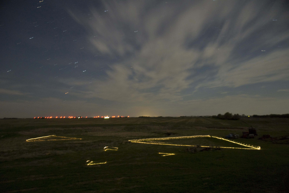
Satellite Fields #1, May 2010, Night view, using flashlights to define the perimeter of each tree formation.
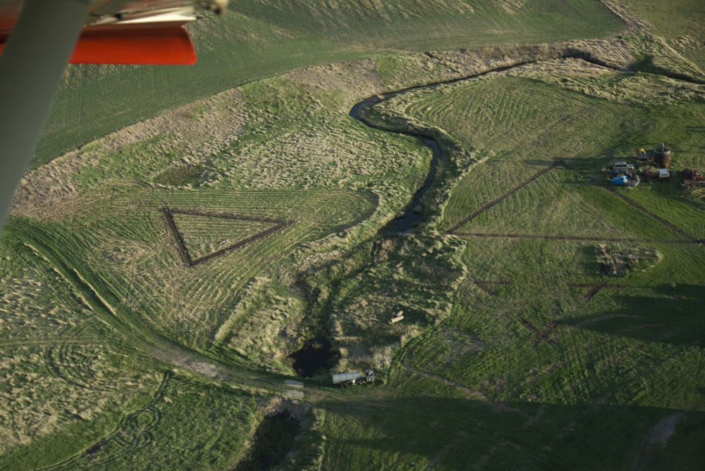
Satellite Fields #1, May 2010, Aerial View. The formation was created by planting 77 trees on 1 acre of land in North Dakota.
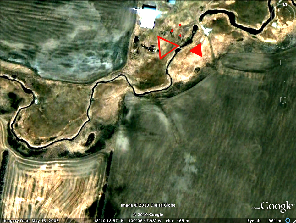
Satellite Fields #1, March 2010, Rendering of Satellite View.
DIVIDED NATURE: Satellite Fields Formation #2 is created with a combination of naturally occurring and genetically modified cottonwood trees. Using these related species,two shapes are created: 1) a triangle and 2) a circle that is “cut out” from the triangle and displaced about 20 feet to the side. The circle is composed entirely of naturally Native Cottonwood trees, which produce a large amount of cottonseeds. The triangle is made of hybridized Sioux Cottonwood trees, which have been bred to be “cottonless”. Every summer the circular formation of Native Cottonwoods will bloom; white fuzz will fly through the air and cover the ground like snow – blurring the divide between the two formations but also making the difference between them clear.
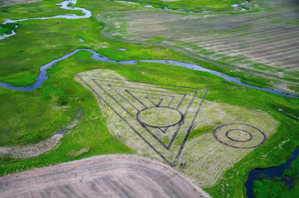
Satellite Fields #2, June 2011, Aerial View. The formation was created by planting 168 trees on 2 acres of land in North Dakota.
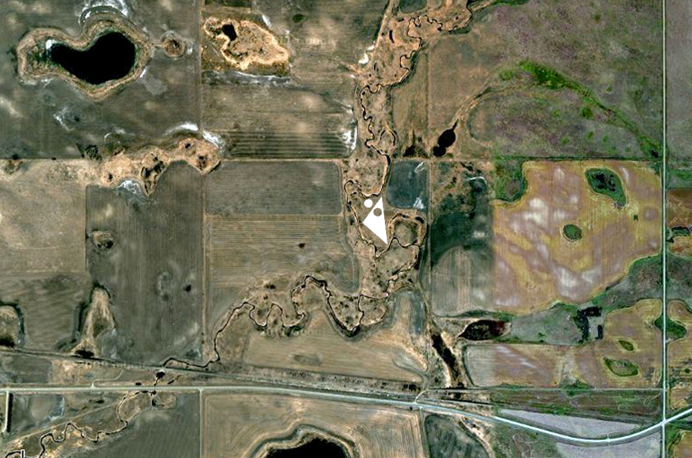
Satellite Fields #2, March 2011, Rendering of Satellite View. This image depicts how the formation will appear on Google Maps. It will take an estimated 5 years for Google to update satellite maps of the region, providing a current view of the formation.
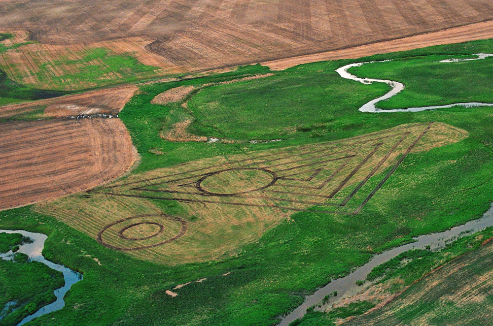
Satellite Fields #2, June 2011, Aerial View.
Nadia Anderson is an artist who divides her time between New York and North Dakota. She has exhibited her photography and video works in the United States in New York, Los Angeles and Portland, and abroad in Athens, Greece and Chungdu,China. Her work has been supported by New York Foundation for the Arts’ Artist Fund and the New Museum’s Rhizome Commission Award. She has also appeared as a guest on National Public Radio and published in academic journals as a classics scholar. Nadia has a dual BFA in Photography and BA Classics, as well as an MA in Humanities and Critical Theory from New York University